Architect | ComputationalDesigner
Chicago Taxi Data Visualization
University of North Carolina at Charlotte
2017-2018
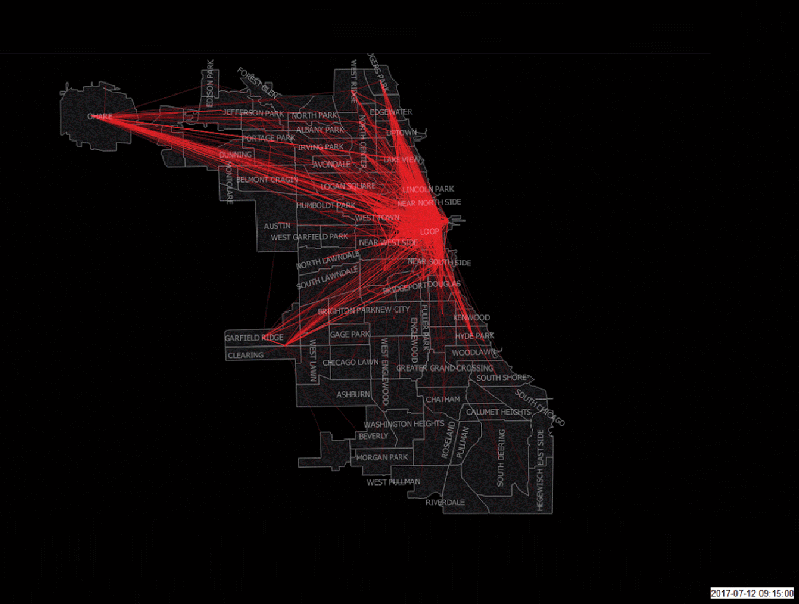
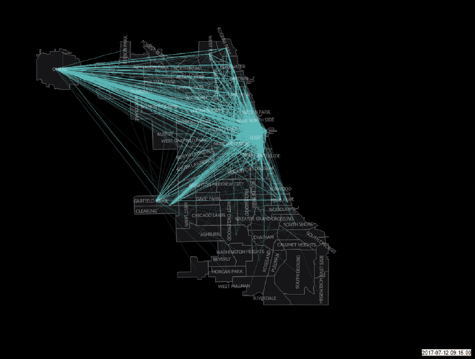
What is the different amount of time taxis spending with passenger and searching for the passenger? What is the flew of these trips on the map, with passenger and empty? This project was my final project in the synergistic course. Our project related to the mobility on demand for the city of Chicago. we receive this data from The City of Chicago, Department of Business Affairs & Consumer Protection (BACP).
Chicago taxi data includes:
-
Taxi ID
-
Trip Start and End Time
-
Trip Length (Time and Distance)
-
Community Area (Census Tract included in some) For Start and End of the Trip
-
Trip Cost & Fare
-
Payment Type
-
Taxi Company
We are going to find an answer to these question:
-
Main nodes of transportation in the city
-
What is the different amount of time taxis spending with passenger and searching for passenger? What is the flew of these trips on the map, with passenger and empty ?
-
Chicago has Divvy, bike sharing system, what is the relationship between flew of taxi and flew of bike during an ordinary working day?
We start working on data with python programming language and there are several challenges in this process:
-
We do not have the Fixed pickup and drop off location, so I choose Tessellation of city based on Taxi data
-
Cleaning data based on Taxi ID and Pick Up and Drop Off Location and Time
-
Creating two datasets:
1/ Taxi with passengers 2/ Empty taxi(without passengers)
For the visualization part:
-
Creating a chord graph that visualizes the all of the trips in one graph
-
Using GIS maps to create two different types of maps for trips in one day and combine these five days in a gif
-
Using carto website for interactive visualization that you visit it on the carto website here.